Amazon

Friday 14 July 2017

Putney Train to Hampton Court Train Station (Linear Walk)

Description:
A lovely a 6.6 mile walk through the Surrey countryside.

If you fancy a bite to eat after the walk you can find plenty of eateries near Hampton court train station. 

.
Distance: 6.6 miles
Time: 2.5 hours
Elevation: 113 foot


from millions at MapMyWalk

Wednesday 12 July 2017

Shere, Surrey. (Circular Walk)

Shere is a beautiful, quintessential English village located between the towns of Guildford and Dorking.  The village offers visitors charming buildings, a stream with ducks, a small museum, a tearoom, two pubs, The White Horse and The William Bray as well as St James Church a 12th century church.


The walk is 7.7 mile starting Shere and finishing in Shere.If you fancy a bite to eat after the walk you can stop off at The William Bray pub or The White Horse Hotel.

Distance: 7.7 miles
Time: 3 hours
Elevation: 739 foot
Map: OS Explorer Map (145) Guildford and Farnham
Start Point: Shere Car Park
End Point: Shere Car Park

Mile 1;
Starting from Shere 

Tuesday 11 July 2017

Ben Nevis, Fort William (Walking Route).


Description;
A 10 mile walk up the highest Mountain in the UK. If the weather is clear you will be present with lovely views of the gorgeous Scottish Highlands. This walk is not for an inexperience hikers, when the climbing Ben Nevis the weather can suddenly change. Be sure to read all the signs at the visitor centre for precautions and equipment needed for the ascent.


Geocaches are available on this walk, there are two geocaches at the summit.

Distance: 10 miles
Time: 7 hours
Elevation: 1,312 foot
Start Point: Glen Nevis visitor centre car park
End Point: Glen Nevis visitor centre car park


Stage 1


To begin the walk, park at the Visitor Centre in Glen Nevis; there may be a charge. Cross the bridge over the River Nevis, which is downstream from the centre. Once across the bridge, turn right and follow the river bank for a few hundred metres; then turn left over a stile, heading up a path between a wall and a fence.


Stage 2

Cross a stile at the top of this and go ahead across a track to meet the original path which started at the Ben Nevis Inn on the left; turn right up the rising path. Follow the wide path which climbs across the hillside. After passing above a small plantation the path from Glen Nevis Youth Hostel joins in from the right (this path leads directly from the Hostel to the main path and gives a shorter route; but there is little car parking at the Youth Hostel). Further on the path doubles back on itself to ascend the steeper, rockier slopes in a wide zigzag. There are grand views up Glen Nevis to the Mamores, with Stob Ban prominent.

Stage 3


The path crosses a couple of footbridges over small streams and curves round, climbing above the valley of the Red Burn. As the head of the burn is approached the path takes a very sharp left turn; please don't use the old path ahead which is eroded and loose. The correct path winds up much more easily to reach the plateau that holds Loch Meall an t-Suidhe, known as the half way lochan - which is slightly optimistic. The walk doesn't approach the actual loch though, keeping well to the right.


Stage 4


As the path begins to climb once more, a junction is reached. Turn right (the path keeping left heads round below the North Face of the mountain). After another half kilometre the path crosses the cascading upper Red Burn stream. The path is good at this point, but after a couple more bends becomes much rougher, a well-worn route through the boulders and scree, climbing relentlessly in a series of very wide zigzags - please stick to the path here to avoid worsening erosion.


Stage 5

Much higher up, the path passes above the steep screes which fall to the right into the head of Five Finger Gully. This has been the scene of many fatalities in descent, when walkers attempting to avoid the North Face of the mountain steer too wide a course and heading too far south and fall into the gully. In good weather, the views of the Glen far below are superb. The top and Carn Dearg - fringed by great cliffs - comes into view on the left.

Stage 6


The gradient now eases as the beginning of the summit plateau is reached. The path passes close to the top of Tower gully, and, just before the summit, the vertigo-inducing top of Gardyloo gully. The summit of Ben Nevis is the highest mountain in the British Isles. The summit area has several memorials, a trig point, and many cairns; some of the memorials have been removed in recent years to prevent the area looking a mess. There are also the remains of the (meteorological) observatory which operated here early in the twentieth century.


Stage 7

The view is tremendously extensive and covers much of the Highlands, but there is nothing more dramatic than peering down the north side, across or down the massive cliffs; again, do not approach if there is snow as there could be cornices of overhanging snow which could collapse if you step on them.. You may spot rock-climbers coming up Tower Ridge or other classic climbs.


Stage 8

The return is made by the same route. In misty conditions and with snow covering the path, very careful navigation can be required to steer a course between Gardyloo Gully and Five Finger Gully. Follow a bearing of 231 degrees for 150 metres, and then a bearing of 281 degrees, to pass the most dangerous section. Once down - a celebration will be in order.


Ben Lomond, Stirling (Walking Route)

Description;
An impressive 8 mile hike up Ben Lomond this walk is not for the faint hearted. While hiking up Ben Lomond you be presented some fantastic views of Loch Lomond and Trossach. 
For after walk you have two pubs you can visit to grab a deserved bite to eat you have Oak Tree Inn and Rowardennan Hotel ...... 

This route also has a couple of geocaches on the make sure to find the one at the top of summit of Ben Lomond. 

Distance: 8 miles
Time: 5 hours
Elevation: 956 foot
Start Point: Rowardennan car park
End Point: Rowardennan car park

Stage 1

Start from the car park (charge) at Rowardennan where there is an information centre and toilets. The mountain is not in view from the car park but can be seen from the metal jetty on the loch shore. The ascent starts from a clearly marked path at the back of the information building. Climb steadily, through oak woods to start with, after a short while cross a track and continue on the uphill path.


Stage 2

Cross a small bridge and soon there are the first views of part of Loch Lomond. Pass through a gate onto the open hill where cattle and sheep graze. The path continues to climb at a steady gradient, the views of the Loch becoming more impressive with each step. Pass through another gate. By the 1990s this section of the path had been eroded until it formed a scar up to 25 metres wide, visible from Glasgow. The National Trust then began a program of repairs and the current, excellent path is only a couple of metres wide. The ground becomes less steep and the final peak comes into view with the prominent zig-zag of the path visible on the right hand side.


Stage 3

Keep following the path as it sticks to the broad ridge of the mountain. There are good views of the islands in Loch Lomond behind. The path climbs steeply on the final ascent to the summit ridge before levelling off to curve to the left around the rim of the very impressive eastern corrie which has been hidden until this point.


Stage 4

From the summit trig point there are stunning views in all directions, particularly of the southern end of Loch Lomond and its islands. It is rare to be alone at the top, as this is one of Scotland's favourite mountains, popular with visitors and locals including fell runners who make numerous ascents in a year. The easiest and most usual route back is to retrace your outward route, but there is a rougher alternative.


Stage 5

For the alternative, harder descent, take the rocky path north-west from the summit to descend very steeply to a col before climbing south-west to Ptarmigan at 731 metres. From here the route follows the nobbly ridge for much of the descent with excellent views down Loch Lomond. Approximately half way down the ridge, the distinctive shape of the Cobbler comes into view alongside the other peaks of the Arrochar Alps on the far side of the Loch to the west. There is a clear path although it is narrow and rocky in places. The wettest areas have been improved with large stepping stones. About two-thirds of the way down the path leaves the true ridge to descend below crags and continue on a direct route towards Rowardennan.

Stage 6

The path passes through a gate and descends more steeply. Before reaching some trees at the top of the woodland bear left to go through another gate and descend alongside the burn. After an open gateway there is a good view of a waterfall. Continue down through the woods until the road is reached. Turn left here and walk along the road passing behind the Youth Hostel. For the last section it is possible to take the path to the right along the shore. This passes a modern war memorial sculpture by Doug Cocker of Dundee. Ben Lomond and its slopes going down to the loch have been dedicated as a Memorial Park to commemorate those who have lost their lives for their country. From the memorial continue round the shore a short distance to return to the car park.

Monday 10 July 2017

Thorney Island, West Sussex (Circular Route)

Thorney Island is a peninsula which juts out into Chichester Harbour, driving a wedge between the Emsworth Channel and Thorney Channel.

Thorney Island is best known for its military airbase, but before the airbase was built there was a small but thriving village here. The thirteenth century Church of St Nicholas is the best remnant of West Thorney.

A lovely a 3 mile walk on the South Downs in West Sussex countryside, with great views looking over Chichester, Chichester Harbour and Bognor Regis. If you fancy a bite to eat after the walk...... This route also includes geocaching.


Distance: 7 miles
Time: 2.5 hours
Elevation: 7 foot
Terrain: Coastal footpaths and country lanes.
Map: Ordnance Survey Pack - Explorer Map 120 ~ Chichester, South Harting & Selsey
Start Point: Thorney Road Car Park
End Point: Thorney Road Car Park


Leave the car park and walk back to the road. Turn left and walk along the pavement. Ignore the public footpath just past the pub and continue until you reach Slipper Road.

Turn left along Slipper Road, walking with the houses on your left and the millpond on your right. When you reach the "private road" sign, don't let this put you off - there is a fingerpost on your left confirming that this is a right of way. Go straight ahead here past Slipper Mill and pass through the gap by the sign for Emsworth yacht harbour. Walk straight ahead here between the boats. When you reach the waterfront and can see some chalet houses, bend left around the front of Emsworth yacht harbour clubhouse, pass the chandler's and follow the concrete route between the boats. At the end of the concrete you will see a fingerpost.
Turn right here. Pass the entrance to Emsworth yacht harbour and head for the black and white posts which you can see ahead. Again don't be put off by the "private" sign - it is a right of way and you will shortly see some more footpath signs to confirm this. Go through the black and white posts and walk between the boats as directed by the white painted blocks of wood on the ground. After a few paces you will arrive at a track between the boats.
Turn right here, walk the shingle track between the boats and you will arrive at the seashore. Look to your left and you will see some fingerposts by a wooden fence.
Go through the gap here and walk with the sea on your right and the chalet houses on your left. At the end of the houses you will see a fork in the paths, with a fingerpost.
Fork right here. You can choose either the high or the low route. Continue for 7km. Eventually you will come to a gate where you will have to give your details before being allowed any further, as this is MoD property. Continue until you reach the buildings and a yellow post with a sign "FV6A".
(It looks like there has been an unofficial diversion here as there used to be a footpath post marking the high water footpath which has now disappeared. That footpath is now getting overgrown and a new path has been created a few metres earlier.) Here you have a choice of footpaths depending upon the state of the tide. Continue straight ahead if it is passable; if not, turn left here along the high-water footpath. Follow it behind the sailing club and through the car park, where you will come to a lane.
Turn right and walk back to the seashore, where you turn left.
Just before the boatyard take the little path running next to the seashore. Continue to the checkpoint where once again you will have to give your name, address and phone number to be allowed to leave Thorney Island. Follow the coastal path until you reach a stile with a fingerpost ahead.
Cross the stile and turn right. Go through the marina, passing over a couple of bridges and continue until you reach a lane.
Turn left here. Go through the metal gate at Thornham Farm House. There is a public footpath sign confirming that this is a right of way. You will soon arrive at a fork to the right, with some fingerposts.
Fork right here. Pass between the house and garage along the driveway. Look for the fingerpost by the house and follow the grassy route. Pass through the metal barrier and walk between the fields as directed by the fingerpost. After a while you gain a fence on your left. Continue to the field corner and follow the enclosed path as directed by the fingerpost, soon to arrive at a road. Cross straight over the road and climb the stile opposite. Go straight ahead across the field and head for the stile. Go over the stile.
Turn right here along the path and walk with the chalet houses on your left, then follow the route ahead on the concrete path through the boatyard.
Soon you will arrive back at the yacht club and chandler's. Bend left here in front of them and retrace your steps through the boatyard. Pass Slipper Mill once more. Just past the mill you will come to some fingerposts. Turn left here for Emsworth and carry straight on for the Sussex Brewery.


Sunday 9 July 2017

Geocaching for Beginners

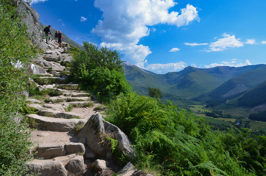
Combining exploring with treasure hunting, geocaching is a great way for families to #GetOutside.
Many of us have fond memories of exciting treasure hunts as children, with Easter eggs and other small treats often the subjects of our searches. These days, though, it's much more normal to find youngsters glued to their television screens, completing quests of a more virtual nature. Technology has certainly affected the ways in which people explore the world and enjoy themselves, but it'd be wrong to assume that old and new can't be combined to great effect. Geocaching is a fantastic example of this.


What is geocaching?

Geocaching can be described in simple terms as treasure hunting for the digital generation. Instead of using the conventional compasses and printed maps more commonly associated with orienteering, participants rely on global positioning system (GPS) technology to find their way to certain points around the globe. These spots are found using coordinates published online by other forum members who have hidden boxes or containers (caches) there.
These boxes - often airtight Tupperware-style containers - can contain pretty much anything. In their most basic form, they'll usually have a log book for hunters to record their names and the dates on which they find the stash. Much of the excitement, however, lies in seeing what other trinkets and souvenirs have been left. If the finder decides to take anything away, they're required to leave something of equal or greater value for the next person to discover - and the chain begins!

How did it all start?

The activity got its big break at the turn of the century when the US government decided to put an end to Selected Availability (SA). This measure was originally put in place to limit public GPS signals, as officials were concerned about the security implications the technology may bring. However, in May 2000, then-president Bill Clinton decided that GPS could be made more useful to people and organisations across the globe if the restrictions were lifted.
Once the button was pressed and the satellites were able to process their new instructions, the accuracy of GPS technology improved massively. In order to celebrate and test the new capabilities, Dave Ulmer, an IT expert from Oregon, decided to hide a box of prizes in some local woodland before posting the coordinates on the internet. Within three days, two people had already set off to find the items after reading Dave's post. The stash comprised videos, computer software and books. They shared their own experiences to others on the web and the excitement and enthusiasm snowballed from there.
The original founder had called his idea the 'Great American GPS Stash Hunt', although this was shortened to 'geostashing' and eventually changed to 'geocaching'; this was because many people felt the word 'stash' had negative connotations.

How popular is it?


While geocaching's birthplace is undoubtedly the US, tens of thousands of Brits now describe themselves as enthusiasts. Its popularity is growing across the world; for a bit of perspective, the official website registered its 2,000,000th find early in 2013.
Geocaching's rise to fame can be put down to a number of factors. To begin with, it requires a certain level of skill from those who take part, which means it tends to offer a real sense of achievement and fulfilment. Add to this some healthy doses of excitement and adventure and it's easy to see why so many families quickly get addicted. While children should only go caching with a responsible adult, it's easy for people of all ages and levels of experience to get involved.

What are the benefits?
One of geocaching's biggest selling points lies in its community. The very nature of the activity requires people to work together to get their rewards, both online and on actual hunts. The geocaching isn't quite over when the items are found - it's then time for the successful hunters to share their experiences online, urging others to get involved while they're at it.
There's little doubt that geocaching promotes physical activity and gets people outside; the extent to which this is true depends largely on the caches chosen and the ways in which they're found. It's become particularly popular with those who don't quite take to conventional sports - especially schoolchildren.
It'd be wrong to ignore the educational benefits on offer too. Over the last few years, an increasing number of official representatives have been popping up at education conventions and expos across the UK. Teachers are beginning to see geocaching as a powerful tool involving practical learning, critical thinking and active engagement - all of which are crucial ingredients in the development of young minds.
So how do I get started?
Equipment-wise, the only crucial component is a GPS-enabled device. In the past this would have meant buying a handheld navigation device (the kind commonly used by hikers, cyclists and general adventurers). Now, however, most smartphones come with the necessary technology and there are plenty of dedicated applications to download for both Android and iOS handsets.
The next step will be to register with an online community. The largest and most established is geocaching.com, which was set up just six months after the first hunt was staged. A number of specialist sites have also been started since, like handicaching.com, which caters specifically for disabled people. Terracaching.com was put together to appeal to more experienced geocachers who may be looking for more difficult or large-scale tasks.


Depending on how serious you want to get and the caches you set out to find, it may be worth purchasing some comfortable walking shoes and durable clothing; other than that, you'll probably already have everything you need to get going with your own geocaching journey - so let the fun begin!

Witley to Haslemere, Surrey (Walking Route)

Description:
A lovely a 6.6 mile walk through the Surrey countryside. 

If you fancy a bite to eat after the walk you can stop off at The Swan pub or The White Horse Hotel.


Distance: 6.6 miles
Time: 2.5 hours
Elevation: 113 foot
Terrain: Footpaths and country lanes.
Map:


West Dean walk, West Sussex. (Circular walk)

A lovely a 2.8 mile walk on the South Downs in West Sussex countryside, with great views looking over Chichester, Chichester Harbour and Bognor Regis. If you fancy a bite to eat after the walk a short little drive away in Singleton you can find the The Partridge Inn

This route also includes geocaching.

Distance: 2.8 miles
Time: 1.5 hours
Elevation: 113 foot
Terrain:
Map:

Banner

Banner